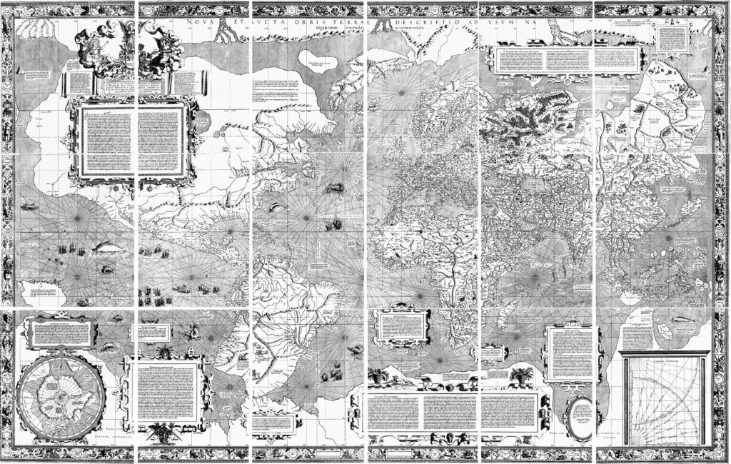
Gerardus Mercator (1512–1594) was a Flemish geographer, cartographer, and mathematician, widely recognized for creating the world-famous Mercator projection. Born in Rupelmonde, which was part of the Duchy of Brabant (modern-day Belgium), Mercator is considered one of the most important figures in the history of mapmaking.
Mercator studied at the University of Leuven and later became known for his expertise in cosmography (the study of the universe). His early work focused on making accurate globes, but he became most famous for his 1569 creation of the Mercator projection. This projection revolutionized navigation by representing the Earth’s surface on a flat map in such a way that straight lines on the map correspond to constant compass bearings, which was extremely useful for maritime navigation.
In addition to his work on the Mercator projection, he made a significant contribution to the development of modern cartography with the creation of a detailed map of Europe, as well as a series of world maps. He also designed globes and produced a comprehensive atlas, the “Atlas” (1595), which gathered all his maps into one collection, laying the groundwork for the future of cartographic publishing.
Mercator’s work was pivotal in the development of accurate maps for explorers and sailors, making it possible for them to travel long distances more effectively. Despite the distortions introduced by his projection (particularly in the polar regions), his contributions to the fields of geography and navigation were groundbreaking.
